
JohnGeo
Solutions Ltd
Solutions Ltd
JohnGeo Solutions Ltd transforms satellite imagery, field data and spatial analytics into actionable geospatial intelligence for conservation, infrastructure, energy and climate projects across East Africa.
We bridge the gap between raw geospatial data and decisions that shape landscapes.
Based in Nairobi, JohnGeo Solutions Ltd works with developers, NGOs, conservation organisations and public agencies across East Africa.
We combine GIS, remote sensing, field data and environmental assessment to create evidence that decision-makers can understand and defend.
A structured workflow connecting field evidence, spatial analysis and practical decision-making.
Satellite imagery, GPS observations, field surveys and verified spatial datasets.
GIS modelling, classification, change detection, suitability analysis and spatial risk assessment.
Translate spatial findings into environmental, conservation and planning recommendations.
Interactive maps, dashboards, databases, reports and decision-ready visualisations.
Combining technology, environmental science and spatial intelligence.
Satellite-based monitoring of land cover, vegetation, environmental change and landscape dynamics.
Professional cartography, spatial databases, web maps and decision-support mapping systems.
Environmental and social assessments, audits and spatial analysis supporting regulatory compliance.
Corridor mapping, habitat analysis and connectivity modelling for conservation and infrastructure planning.
Spatial baseline assessments, farmer eligibility analysis and monitoring for nature-based projects.
GPS-enabled data collection using KoboToolbox, Survey123, QField and related digital platforms.
A combination of GIS platforms, satellite datasets, field technologies and spatial modelling methods used to turn geographic data into practical intelligence.
A sample of mapping, monitoring, infrastructure and conservation work.
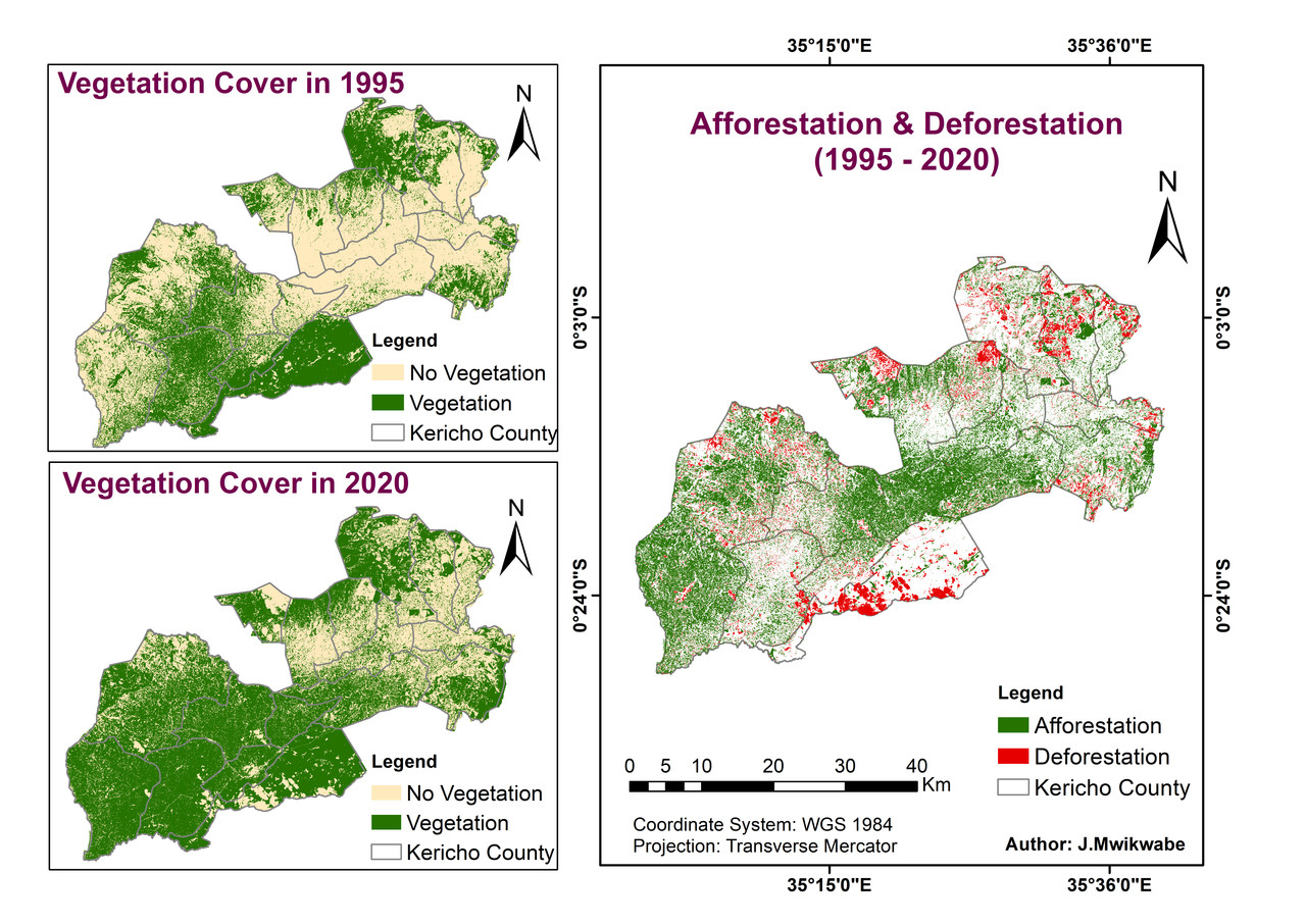
Forest change detection and monitoring
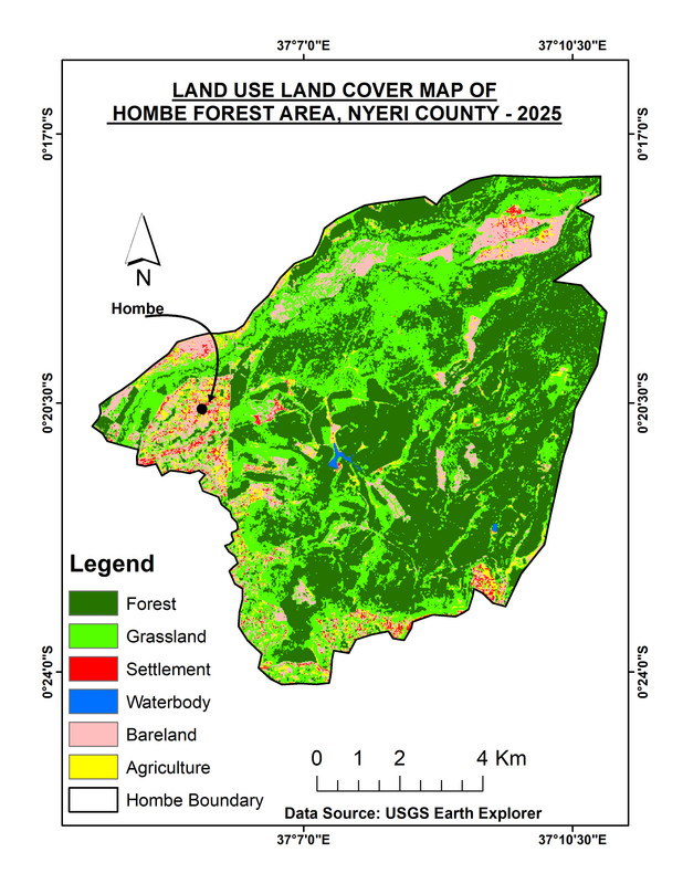
2025 land-use and land-cover analysis
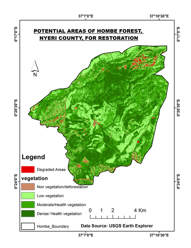
Spatial assessment of degraded areas

Site suitability and spatial assessment

Wildlife connectivity and ESIA mapping

Ecological sensitivity mapping
Tell us about the site, challenge or decision you are facing. We'll help determine the right spatial approach.
Tell us about your project, location, land area and the type of analysis you need. We'll scope the appropriate geospatial approach.